Framed National Geographic British Isles 1937 Map Print
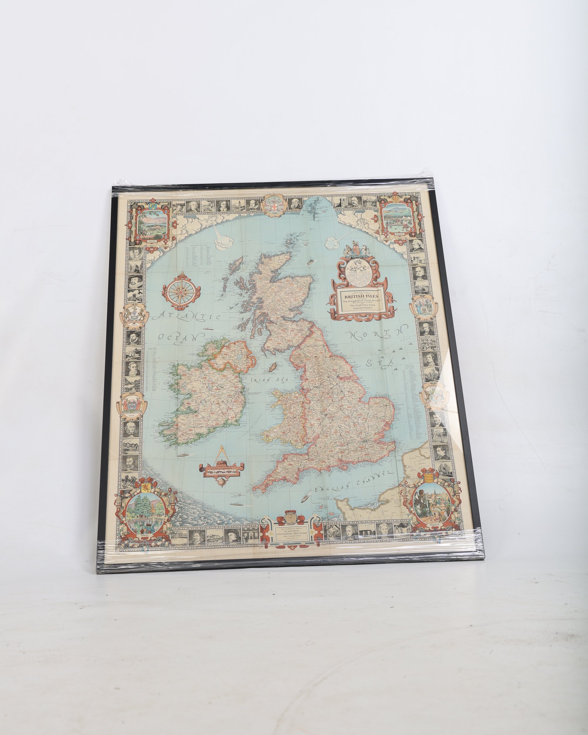
This framed National Geographic British Isles map print features decorative historical details and illustrated borders, presented in a modern black frame.
In stock
Secure Packaging
Authentic Antiques
Expert Support
This framed decorative print depicts the National Geographic British Isles map, originally designed by I.E. Riddford and copyrighted in 1937. It outlines the counties and major geographic details of Great Britain, Northern Ireland, and the Irish Free State. The map is bordered by illustrative panels showcasing historical figures and regional coats of arms, rendered in a classic cartographic style with soft blue and pastel tones.
The print is presented in a modern, clean-lined black frame behind glass. It is currently wrapped in protective plastic film and comes ready to hang with a cord attached to the reverse. This piece is ideal for bringing a touch of vintage cartographical interest to a home office, library, or living room. Please note there is slight waviness on the paper surface visible under the glass, consistent with framed paper items.
Have a question about this piece? Need more details or photos? Fill out the form below and we'll get back to you as soon as possible.