1 / 7
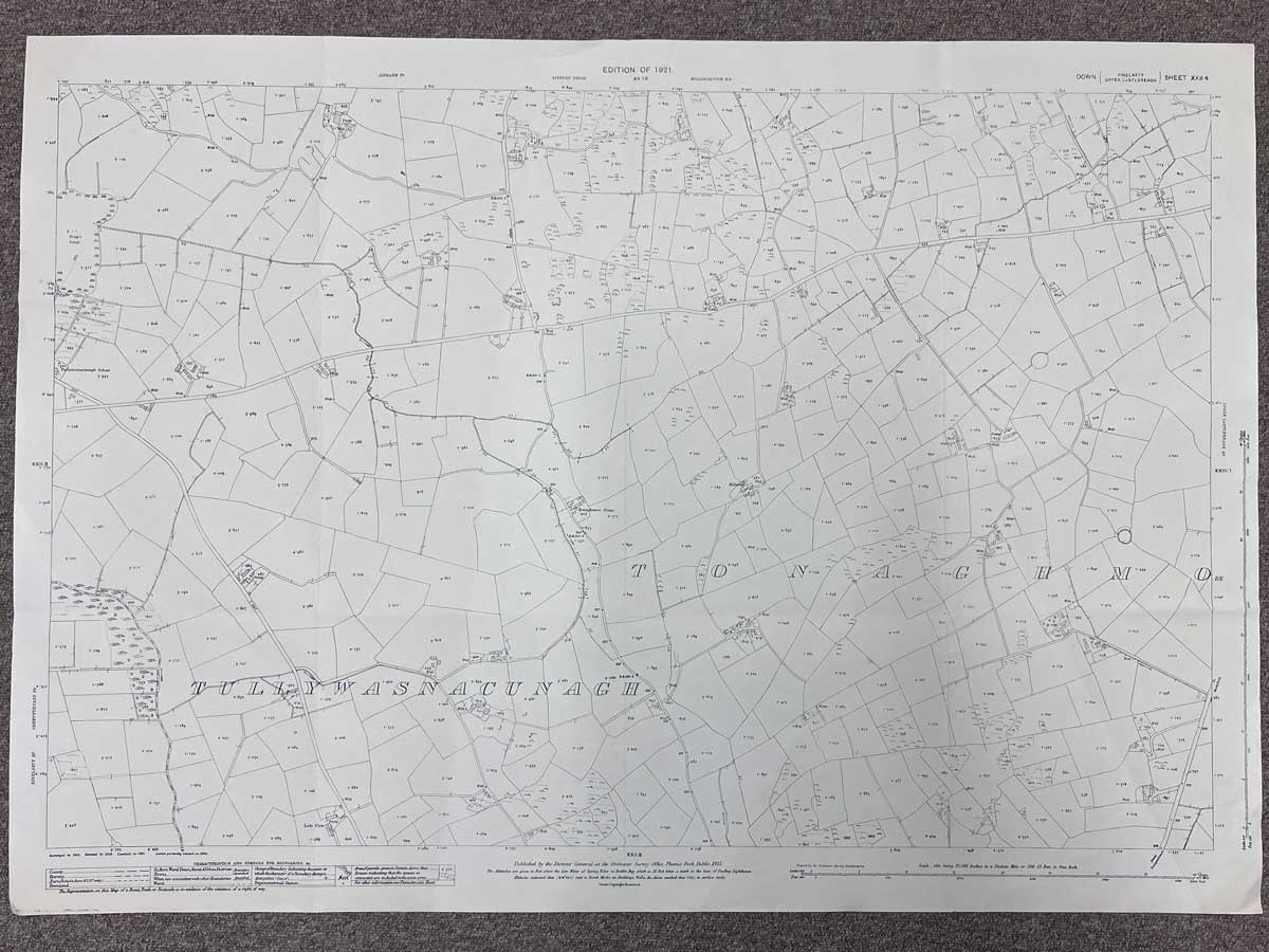
Published 1921 by Ordnance Survey Office, Phoenix Park, Dublin
1:2500 scale
The map covers an area between Saintfield, Lisbane and Ballynahinch.
Landmarks include Tullywasnacunagh School, Tonaghmore House and Hillcrest.
The main roads on the map are were Tullywest Road meets Middle Road, although they aren't labelled as such.
Dimensions: Length 104cm x 74cm (approx.)
Approximate area:
Have a question about this piece? Need more details or photos? Fill out the form below and we'll get back to you as soon as possible.