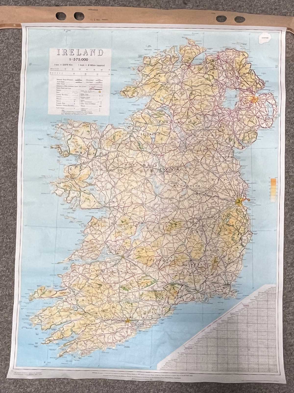
Plan of both Ireland and Northern Ireland.
Printed 1985 by the Ordnance Survey Office, Phoenix Park, Dublin.
1:575,000 scale.
1 inch= 9 miles (approx.)
It depicts National roads, Trunk and Link roads, Distance in Miles between towns, Scenic Roads and Views, Railways, Rivers, County Boundaries, Altitude, Airports and more.
Dimensions: Length 83cm x 63cm (approx.)
To keep up to date with all that goes on at the Emporium follow us on Facebook or Instagram.
On The Square Emporium is one of Ireland’s Largest Antiques shops stocking thousands of vintage and antique items including Edwardian, Georgian and Victorian furniture, desirable collectibles and stunning decor ideas for your home. Can’t find what you are looking for? Contact our team for help on sourcing it!
Have a question about this piece? Need more details or photos? Fill out the form below and we'll get back to you as soon as possible.
![Historical [pictorial] Map of Ireland](https://onthesquareemporium.com/wp-content/uploads/2021/10/31D8FDD5-7B3D-4826-BAD5-26BDC5DE8869-768x768.jpeg)