1 / 4
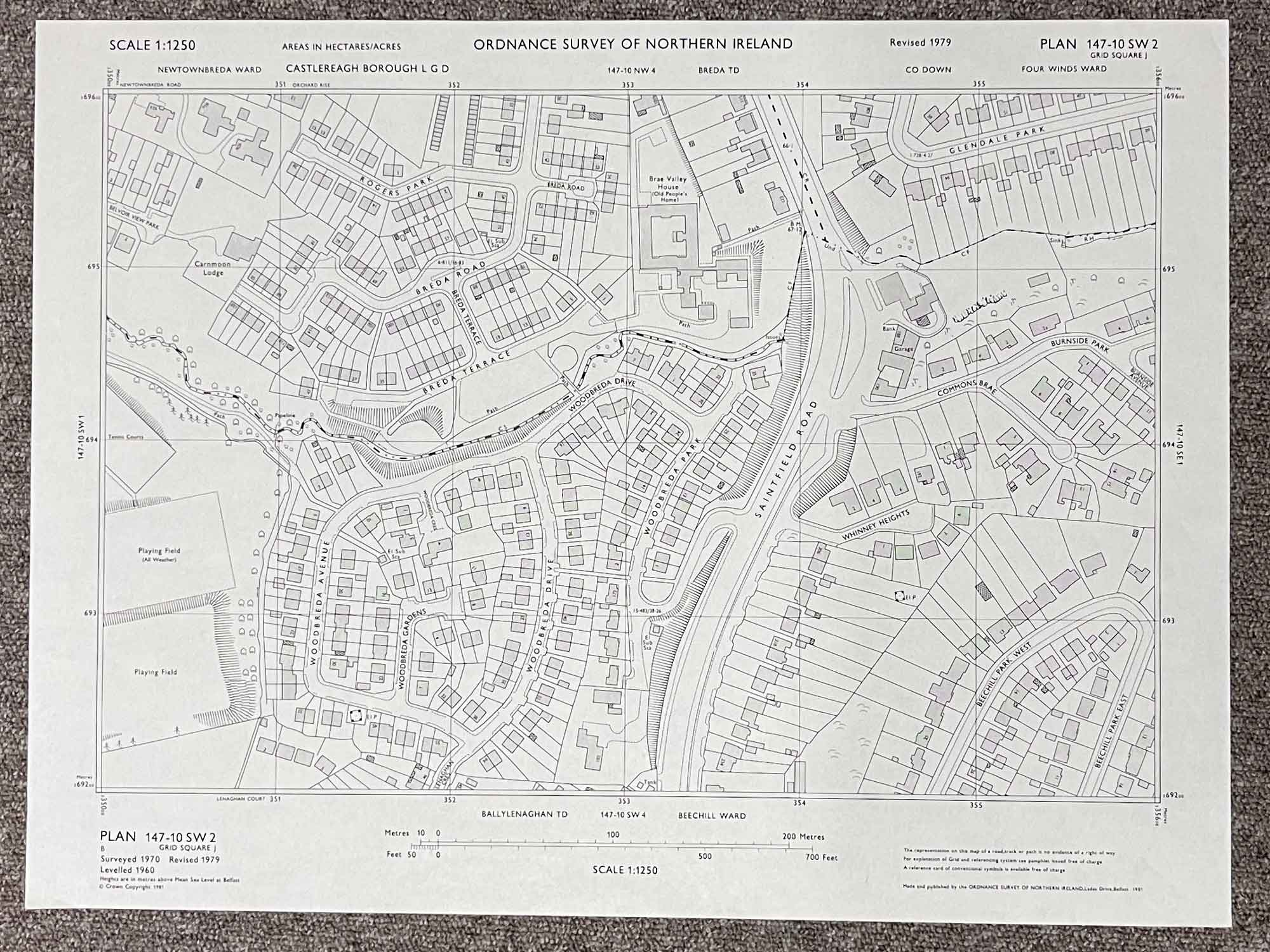
Plan 147-10 SW2
Surveyed 1970, partially revised 1979
Published in 1981
1:1250 scale
The map covers a portion of the Saintfield Road
Landmarks include Woodbreda Avenue, Woodbreda Gardens, Woodbreda Drive, Woodbreda Park, Breda Terrace, Brea Road, Rogers Park, Commons Brae, Burnside Park, Whinney Heights and Beechill Park West & East
Dimensions: Length 55cm x 42cm (approx.)
Approximate area:
Have a question about this piece? Need more details or photos? Fill out the form below and we'll get back to you as soon as possible.