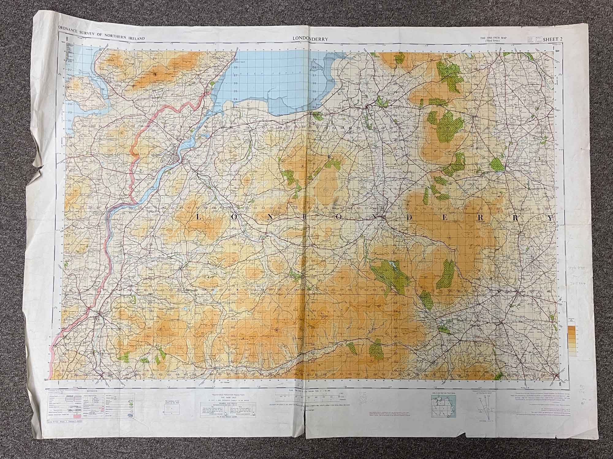
The 'One Inch Map (Third Series)', Sheet 2
Printed for D. Survey, Ministry of Defence, United Kingdom by Ordnance Survey
Surveyed 1965, and reproduced 1969
1:63,360 scale (1 inch to 1 statute mile)
Map covers most of County Londonderry, Northern Ireland
Topography shown in feet
Dimensions: Length 107cm x 79cm (approx.)
A little bit worn around some of edges but otherwise intact, with vibrant colour
To keep up to date with all that goes on at the Emporium follow us on Facebook or Instagram.
On The Square Emporium is one of Ireland’s Largest Antiques shops stocking thousands of vintage and antique items including Edwardian, Georgian and Victorian furniture, desirable collectibles and stunning decor ideas for your home. Can’t find what you are looking for? Contact our team for help on sourcing it!
Have a question about this piece? Need more details or photos? Fill out the form below and we'll get back to you as soon as possible.
![Warning Sense of Humour Metal Sign [8340]](https://onthesquareemporium.com/wp-content/uploads/2023/01/My-Sense-of-humour-768x1152.png)