1 / 4
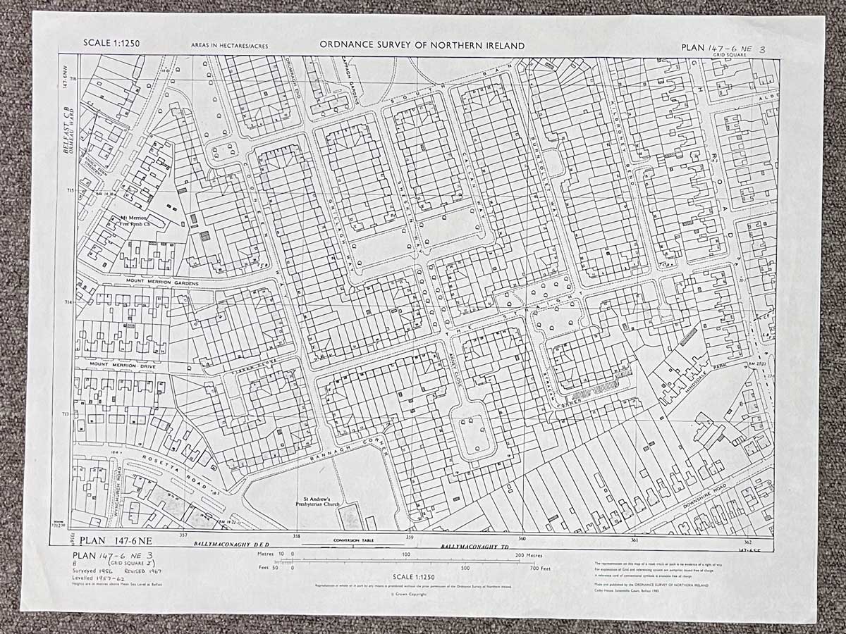
Plan 147-6 NE3, Grid Square J
Surveyed 1956, revised 1967
Printed 1985
1:1250 scale
The map covers an area between Mount Merrion Avenue and Cregagh Road
Landmarks include Mount Merrion Free Presbyterian Church, St. Andrew's Presbyterian Church, Mount Merrion Gardens and Drive, Cooneen Way, The Straight, Burntollet Way and Kilbroney Bend
Dimensions: Length 56cm x 43cm (approx.)
Approximate area:
Have a question about this piece? Need more details or photos? Fill out the form below and we'll get back to you as soon as possible.