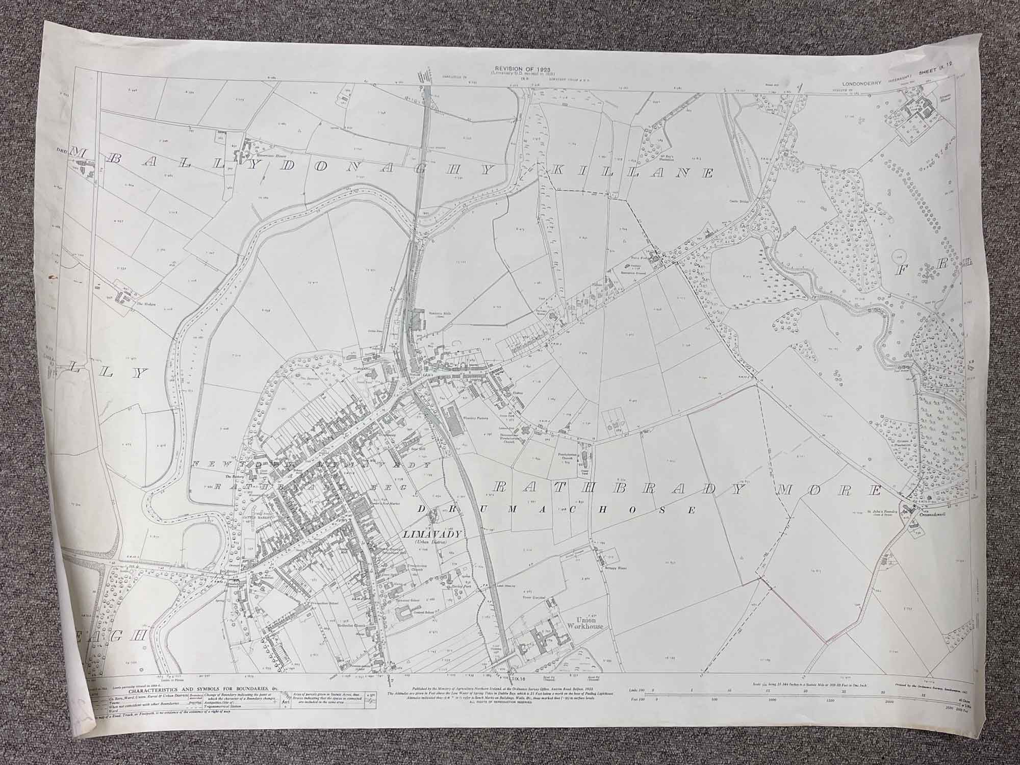
1 / 4
Sheet IX 12
Surveyed 1904, revised 1923
Printed 1969
1:2500 scale
The map covers Limavady Urban District, County Londonderry.
Landmarks include the town of Limavady, Crossnadonnell, St. John's Foundry, Streeve House, McKay's Plantation and Riverview House.
Please note that there are some very light red pencil markings on the lower right portion of the map (see photos)
Dimensions: Length 104cm x 74cm (approx.)
Approximate area:
Have a question about this piece? Need more details or photos? Fill out the form below and we'll get back to you as soon as possible.


![D.C.L Whisky Decanter [w197]](https://onthesquareemporium.com/wp-content/uploads/2023/08/WEBSITEITEMS-70-768x1152.jpg)